Running the Tour du Mont Blanc
Part of the magic of the Trail du Mont Blanc is in the range of the experiences it affords. During the day, you can be at the summit of a wild mountain pass and then later that evening eating a tender steak from the local farms and sipping a fine wine. There are dozens of places to stop along the route, ranging from simple farmer’s huts offering bread and cheese to well-stocked mountain chalets and even luxury hotels in some of the larger towns. The infrastructure permits the option of hiring a taxi services to portage your bags from one town to the next, so you can run or hike without even carrying a change of underpants - never mind a tent, sleeping bag or multiple days worth of food. This juxtaposition of civilization and services with a rugged mountain wilderness isn’t found in the United States and it’s one of the reasons that drew my partner Megan and I to the Trail du Mont Blanc. The other reason was the terrain: steep, rocky trails with sweeping mountain vistas, made famous by the Ultra Trail du Mont Blanc that traverses the entire 106 mile route in one go.
We were going to take a big more time to circle the mountain, but we were both experienced ultra runners we wanted to push ourselves. Our itinerary had six days on the trail with one rest day in the middle. Our first three days would be slightly mellower to get us into the rhythm of the trail. After a respite in Courmayeur, we’d tackle three bigger days before returning to Chamonix. We’d worked with a local company called Run The Alps to organize our adventure, who specialize in trips in the region for those looking to go a bit faster and lighter than the average hiker. They booked all of our accommodations and organized our bag transfers, so we didn’t have to worry about anything other than running.
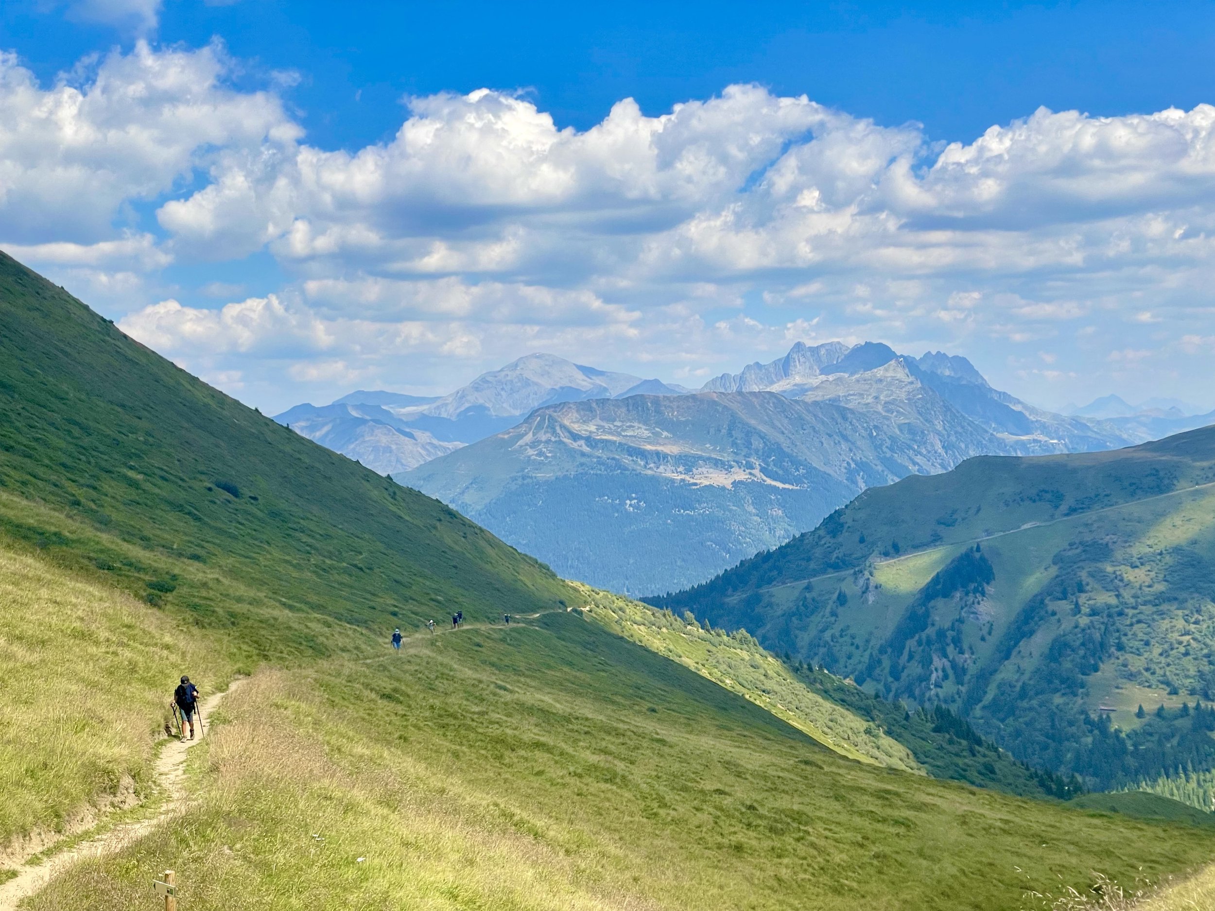
From the Victorian-era ski posters to the covers of trail running magazines, Chamonix Mont Blanc is one of those places with an impossibly impressive reputation. But jogging through the valley on our way to Les Houches surrounded by snow capped peaks, the reality exceeded the hype. On our first day, we set out from Chamonix planning to do about 16 miles to Les Contamines. The first six miles along the valley floor were some of the most runnable of the whole trip. After passing through the town of Les Houches, we took a left turn up the trail towards the Bellevue cable car. I remarked to Megan that it felt like we were going straight up the side of the mountain, a phrase I would make ample use of in the coming days. This is an “alternate” route and it adds significant extra climbing but it is absolutely worth it. The trail eventually tops out at the Col de Tricot and affords sweeping vistas of the valley. From there, it was all downhill to Les Contamines on trail that was much smoother and more runnable than the technical rocky descents we’d encounter later in the trip.
Climbing up the Col de Tricot
Descending the backside of the Col de Tricot
We ended our first run at the Hotel Gai Soleil, a bed in breakfast that afforded us a private room with ensuite bathroom. Most of the places we’d stay wouldn’t have quite this level of amenities, but Les Contamines was an actual “town” with a few businesses and restaurants. Although most of the restaurants were closed when we arrived in the afternoon, we were able to grab a sandwich at the small grocery store. For dinner at the Gai Soleil, I had a steak made from local beef. It was one of the most tender and delicious pieces of meat I’d ever eaten, let alone in the middle of a trek!
We set out from Les Contamines the next day and headed towards Valle Des Glaciers. Our second day was another 16 mile route and this one started climbing right away. The first eight miles were uphill as we ascended 3,600 feet up to the top of the Col du Bonhomme. This trail had the familiar European steepness we’d experienced yesterday, and I again remarked how it felt like we were going straight up the side of the mountain. It turns out Europeans aren’t as fond of switchbacks as Americans, preferring to build their trails along the most direct route. I kind of liked the verticality on the way up, but the way down was a different story. The descent from the top of the col down to Chapieux was 2.8 miles with an average of 19% over rough and rocky terrain. A few hours of climbing had already tenderized our quads, so this section just felt pummeling. Fortunately, we were able to buy a coke at the bottom before beginning our next climb up to our refugee for the day.
The remaining climb was a relatively mild few miles before we got to Les Mottets. The lodge is built own a family farm and is much simpler than the place we’d stayed in Les Contamines. There’s no private bathroom, but the location is worth it. Nestled at the top of the Valle des Glaciers, we watched the sunset throw deep purples and reds across the mountains as we sat in lounge chairs on the patio. The dinner was a big family-style affair and while the food wasn’t as delicious as the previous nights, the camaraderie with our fellow trekkers and the French folk songs played on an automated accordion were just as special.
Entering the Valle des Glaciers
Refuge Les Mottets
Leaving Les Mottets, we continued climbing out of the Valle des Glaciers and up towards the summit of the Col de la Seigne. We’d already knocked out half of the elevation gain the day before, so it didn’t take us long. At the top, we crossed the border into Italy and had a wide view of the snow capped peaks across the way. One of the perks of running all the way around the Mont Blanc Massif is getting to see it from every single angle. The previous day at the top of the Col du Bonhomme, we’d seen the lower elevation shoulder of the range which still had green tundra up to its summit. At this day’s high point we were closer to the center and to Mont Blanc itself, which is snow capped and glaciated year round.
To end the run, we descend down into Courmayeur - the Italian ski town that is on the opposite side of Mont Blanc from Chamonix. Our quads were completely shot and the last three miles of downhill trail switchbacked through the trees, roughly following the line of a gondola overhead. Although Megan and I had committed to covering the entire route on foot, this is the one place I would consider taking the mechanical assistance if I ever did the route again. The descent was filled with rocks and roots, and because it was in the trees there weren’t even any solid views. By the time we got to Courmayeur, our legs were jelly. Before even heading to our hotel, we stopped at a restaurant and ordered two pizzas. The food in Italy was some of the best of the whole trip! Fortunately, we had a full rest day at a proper hotel - the Bouton d’Or - to make the most of it.
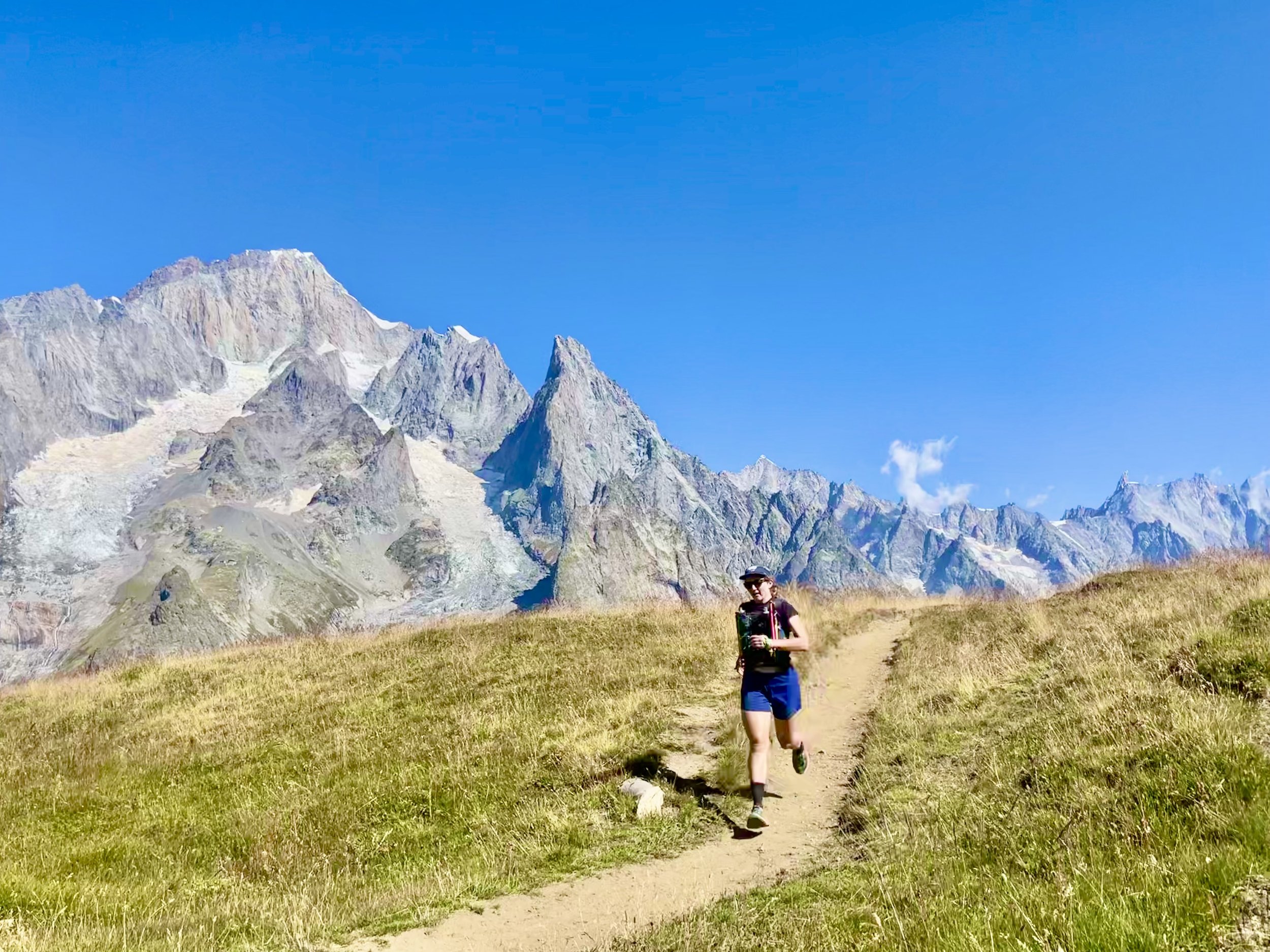
The high point of the trail near Courmayeur
Unfortunately, I would spend that rest day laying in bed, frequently visiting the toilet, my stomach wracked with food poisoning. I don’t know if I got it from something I ate (possible culprits include: undercooked meat, questionably refrigerated cheese or sausages) or the water along the trail (the previous day, I’d used my filter to get some out of a small pond that could have been contaminated with livestock poop). Whatever the cause, I wasn’t able to eat much of anything and I was more than a little worried about how I’d fair the following day on the trail. The only consolation to this whole situation was that we our hotel was the nicest of the whole trip. The room was large and comfortable and the decor paid homage to the decades of mountaineers who’d explored the region.
After a very unrestful day off, our fourth trail day would take us from Courmayeur to La Fouly. This would be our longest day of the trip, a little over 20 miles with two large climbs. Although I felt a lot better than the previous day, within the first hour on the trail I could feel the lack of calories in my body. After we’d been hiking for less than an hour, I felt like I was falling apart but my troubled stomach still wouldn’t let me eat much. I’ve had stomach issues in long ultras, but it’s a different kind of challenge to be feeling so empty at the start of the day. After three miles of steep climbing up to the Refuge Bertone, the trail rolled into Arnuva. This eight mile stretch would have been pretty runnable, but a fast walk was all I could manage. By the time we got to Arnuva on the opposite edge of the valley, I was really feeling empty. I was able to drink a coke in town, but we still had the longest climb (and descent) of the day up to the highest point of our trip: the Grand Col Ferret.
The Grand Col Ferret comes around mile 60 of the Ultra Trail du Mont Blanc and many racers encounter it at night. The role the epic climb holds in the race motivated me to keep pushing up it, knowing that however poor I felt was nothing compared to how those runners would. I wasn’t setting any speed records, but I slowly made my way up the climb. Megan patiently saw me to the summit of the Col and then at the top she set off to run down to La Fouly. This is one descent that might have actually been easier than the climb. I barely ran a step and instead slowly made my way to the bottom - with one emergency visit to the bushes along the way.
Arriving in La Fouly, I was depleted but proud that I’d managed to make it the whole way. I still didn’t have much of an appetite, but by the time dinner came around I was able to eat a full meal and I knew the next day would be easier. We stayed in our one shared dormitory of the trip - the Auberge des Glaciers - but our room only had one other couple. Everyone was quiet, in bed and asleep by 10pm. We’d all had a hard day, after all.
Megan seeking shelter on the windy summit of the Grand Col Ferret
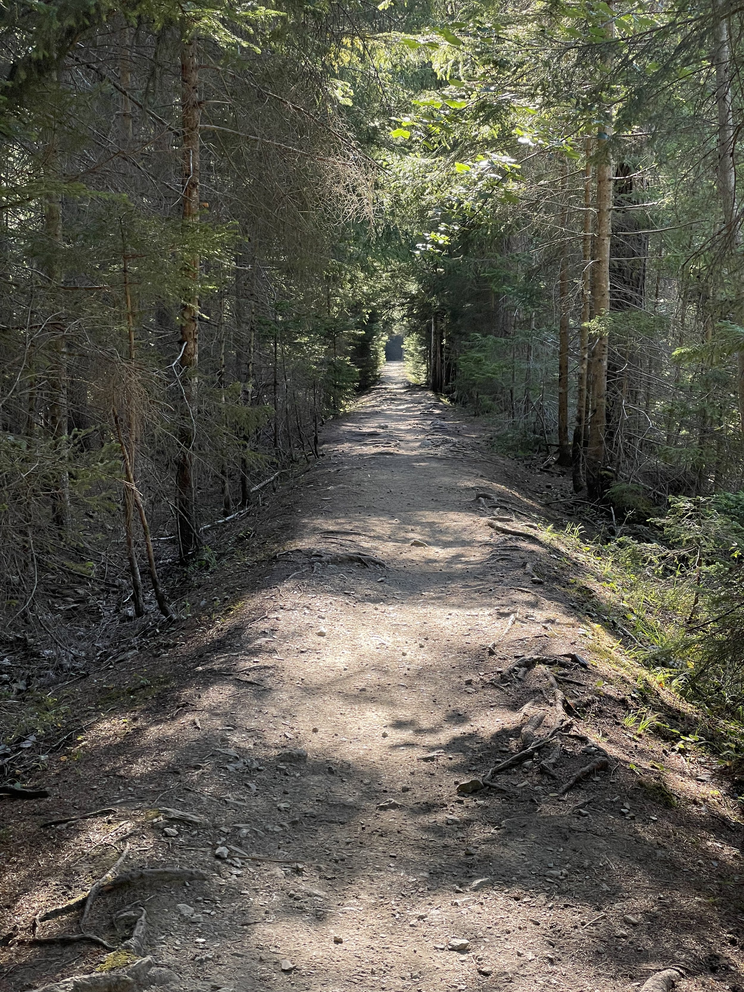
I work up feeling much better than I had the day before, a solid meal immediately helping to recharge my body. The trail started off with a moderate downhill on a section of trail that flowed like a dirt sidewalk through the forest. Almost all of this day’s route would be below the tree line. Our first short climb took us up to the town of Champex Lac, which is the middle C in the CCC race from Courmayeur and Chamonix. After a few flat miles around the lac, we climbed up to our highest point for the day, peaking just over 6,500 feet at the top of the Montée de Bovine. That climb is named for the little village of Bovine, an aptly named community with significantly more cows than people. We stopped there for a quick snack before the long descent into Trient. Of all of the days of the tour, this one was relatively unremarkable. We were further from the glaciated part of the massif and at lower elevations, so we didn’t have any sweeping views. Or maybe after five days on the trail, we’d just gotten spoiled.
The town of Trient was very small and when we arrived around 2:30 in the afternoon, everything was closed. We’d run into this problem a few times already - the rhythm of the trail was definitely to stop for lunch mid-hike and arrive at your final destination between 4 and 5. Dinner wasn’t served until 7, so we had to scrounge up something to eat. After a bit of searching, we found a hostel that was selling chips and soda, which would have to do. Maybe we’d finally learned our lesson not to arrive to a small mountain town starving in the early afternoon and expecting to find a sandwich, but with only one day left on the trail it wouldn’t really matter. We spent our last night on the trail at the Hotel la Grande Ourse, which was a decent but unremarkable lodging. We had a private bedroom, but a shared bathroom. And the dinner was a filling if unremarkable meal of chicken and rice. Still, it was bittersweet knowing that the follow evening we’d be done with our journey and back in Chamonix.
The sidewalk descent out La Fouly
This route certainly saves the best for last. We chose to go an alternate route than a lot of hikers, following the course of the UTMB to give us a total distance of 17.5 miles with 5,600 feet for the day. This course was marked as “epic” in our guide from Run the Alps and it felt like the hardest day of the route, not counting my stomach issues. We started with a climb up to the Col des Montents, which brought us over the shoulder of the mountains and offered the most sweeping view of Mont Blanc and its glaciated peaks we’d seen on the whole trip. We had a nearly 360 degree view of the massif, its jagged edges rising like the teeth of the earth all around us. We stopped here to revel in the joy of what we’d done so far. But there was still a lot left in the day.
After descending down from the Col, we immediately began our last long climb up to the Tete aux Vents. This last ascent was an incredible 1.5 miles with 2,000 feet of elevation gain going, truly, up the side of the mountain. It was the only time in the trip when I felt like I might need to ditch the trekking poles in favor of scrambling with my hands. This final climb caps off the CCC and UTMB races, a fitting and unforgiving finish to those formidable events. After crawling our way up to the summit, we had a long downhill to the Flégère cable car and then to the town of Chamonix. As was often the case on the route, we had the option to use the gondola as a “transfer” to cut out a significant portion of the descent. But we’d powered ourselves through every single step so far and we weren’t going to stop now.
The final four miles dropped almost 2,500 feet and at this point our legs were about as bouncy as bags of sand. We ran/walked/hobbled down the hill, over the rocks and roots we’d gotten used to at this point, until we arrived at the river path that would take us back into the heart of Chamonix. Arriving at the place where we’d started our journey seven days ago, I had the sudden feeling of having never left at all. The valley looked the same. The crowds of tourists were the same as when we’d left. It felt like waking up from a dream. Had we really just done all that? My throbbing quads were a reminder that, yes, we had.
Our final descent into Chamonix


